Durante la residenza d’artista presso l’Università di Malmö, paesaggisensibili ha sviluppato un progetto fotografico che ha coinvolto ricercatori e attori del territorio per una riflessione critica sui mutamenti che ne hanno modificato il paesaggio nell’arco di pochi decenni, concentrandosi sulla fascia più esterna della città delimitata dai ring.
Laboratorio di innovazione e sperimentazione, la città ha saputo reiventarsi a partire dal crollo dell’industria navale assumendo negli anni il ruolo di nuovo polo universitario, centro per start-up e giovani imprese.
Geograficamente compatta, socialmente ed economicamente segregata, piccola nelle dimensioni, ma giovane, dinamica e globale (183 nazionalità e metà della popolazione con meno di 35 anni). Malmö è una città di contrasti e di primati, nel bene e nel male.
Ed è su questa complessità composita che intreccia, rinnovamento, crescita spasmodica e domande su quello che verrà domani, che il racconto fotografico posa lo sguardo. Per un confronto critico, aperto e partecipato.
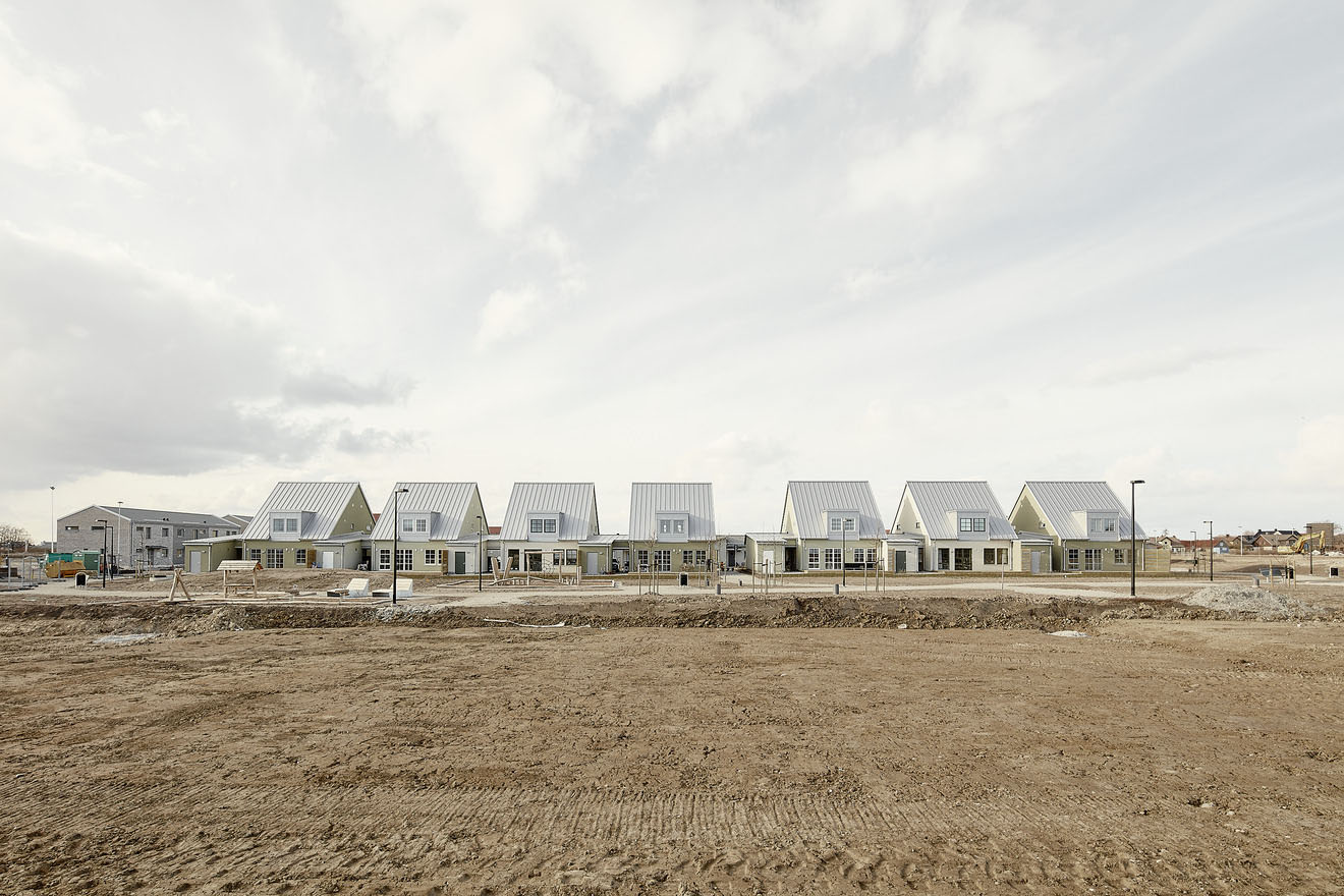
Photo: Alessandro Guida.

Landscapes in transition
“The landscape is intended as a text, a set of stories, memories, and signs which, as such, must be decoded, read, and understood; it is the result of a cultural process, a way of looking, an image which keeps being cultivated and nourished collectively. Through photography, the landscape becomes a visual experience”
Frits Gierstberg, curator
Throughout the month of April, the IUR’s artist in residency duo, paesaggisensibili, has developed a visual project which investigates “territories in transition” in Malmö, places where changes are modifying the landscape. This methodology implies the use of photography as a cultural tool to produce a new layer of knowledge.
The main goal was the elaboration of a new territorial narrative to increase the awareness of the landscape’s consistency and forms; hence open the debate to a broader public and provide the professionals and experts with more insights coming from the perception of the space.
How is the landscape about to change? How present dynamics will be reflected in spatial terms? What are the issues and the problematics at stake?

Photo: Alessandro Guida.
The research was the occasion for a journey through the space contained within the two ring roads (Inre and Yttre ringvågen), a collection of different worlds, each with his own character and identity, all part of the same urban organism, today more than ever, seeking to define itself.
The itinerary started on the west coast heading north-east along the ring roads except for some digressions following specific hints received during the interviews with the local voices. The dialogue with the experts and the researchers took place prior to our photographic investigation on the field, providing us with an important range of elements to understand the current territorial dynamics characterizing the region.
The outcome of this exploration is a visual representation of these territories, with the aim of offering an overview on the city’s urban transformation and, at the same time, a thought-provoking reflection on the contemporary landscape which gradually materializes. New forms mark the space, new relationships are established, new communities created, new values recognized and acquired.

Photo: Alessandro Guida.

Malmö is one of the regions in Sweden where rapid and profound socio-economic and demographic trends have radically and rapidly transformed the landscape: the city embodies the complexity of the urban condition today.
One of the earliest and most industrialized towns of Scandinavia, the city was severely hit by the industrial decline over the years 80s. However, despite the critical moment, the city was able to make a turnaround and build a new vision based on culture and knowledge, becoming a laboratory of urban innovation. In the new millennium, new infrastructures, among which the tunnel and the bridge which connect Malmö to Copenhagen in Denmark, as well as the new university center and the transformation of the western portion of the harbor (Vastra Hamnen) have all given way to a profound metamorphosis that has rapidly modified its face.
The Öresund Bridge strengthens new metropolitan scenarios, assigning to the city a new international role. Since the start of the new century Malmö has attracted new biotech and IT companies, students, expats, new migrants, and refugees from all over the world, growing by over 3000 units every year. This dynamic has made the trend for the past twenty years during which the main goal has been the provision of new houses, workspace and logistic facilities driven by what we can call an urbanization bulimia.
Despite this, the GDP is not growing as one would expect and the city remains the urban area with one of the highest unemployment rates in Sweden, highlighting the need for complex answers to tackle the contemporary societal changes which have happened too drastically and too fast.
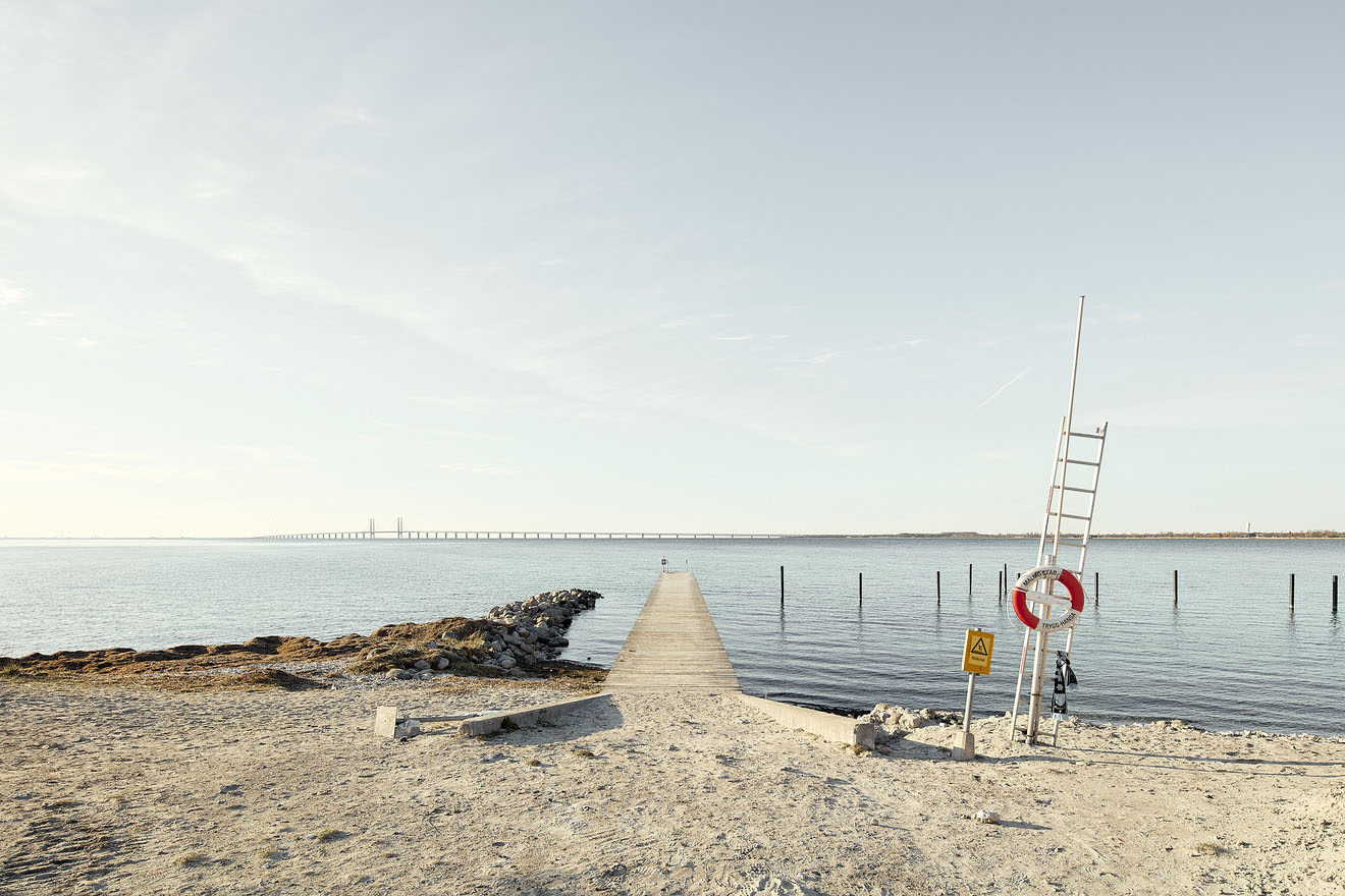
Photo: Alessandro Guida.

In the overall dynamic of renewal and spasmodic growth, this photographic work registers the present reality observing and capturing in an image the personal experience of this landscape.
Questioning what it would be tomorrow, the city stops and observes itself.
To better understand we must pause and look at the city “as something alive, as an organism that breathes, as a large body in transformation” as used to say the famous Italian photographer, Gabriele Basilico. Portraying the city means “looking for a pause in her breathing, almost a state of awaiting for something that is about to happen, which lies before us apparently invisible, yet is ready to reveal itself if observed in the right way”.

Photo: Alessandro Guida.

A new narrative for Malmö
Our journey started by the seashore on the west coast. The coastline brings up the industrial memories which include abandoned quarries, docks, and dumps. They have all become sanctuaries of nature protection. Klagshamnsudden, a strip of land that was built during the construction of a small quarry to produce cement, and not far away, another crater, the legacy of an impressive mining activity that spanned over the twentieth century. Production closed in Limhamns Kalkbrott in 1994 and nature returned occupying the empty cavity and turned it into an oasis of protection for endangered species. Today the steep walls of the quarry protect the new ecosystem and force the urban sprawl to a halt. Along the edges, on each side, there are new construction. The city is pressing on the borders and does not seem to give up.
The rural countryside is just a few steps away. The best fertile land in Europe is there and counts the meters from the next construction site.
Summerhouses and vegetable gardens preempt the city. They occupy the remaining spaces along the traffic routes, on the edges of the ring roads and highway links.
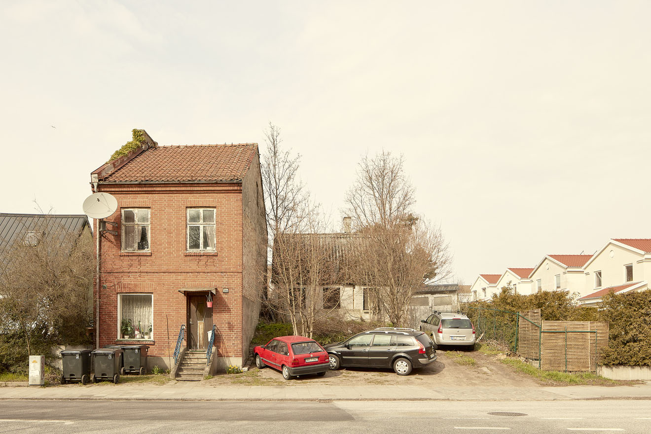
Photo: Alessandro Guida.

Before us, the new district of Hyllie. International center was born as an extension of Copenhagen airport, an open-air construction site located onto the ring system at the exit of the bridge. Shopping area, intermodal exchange platforms, hotels, and residential buildings: a dense, dry, immaculate place, absence of greenery, concrete. This is a landscape that thickens by superimposing the landmarks of yesterday and today in the new city’s skyline.
Clear and sterile urban space, variations of semiprivate spaces, urban rooms, sudden contrasts between full and emptiness that open windows onto the countryside.
More construction sites are not far away. New expansions are ongoing in the village of Tygelsjö, one of the many villages scattered in the rural areas surrounding the municipality of Malmö.
The countryside is characterized by intensive agriculture, numerous greenhouses, and water collection tanks for irrigation purposes.
We are back on the edge of the outer ring. Vacation homes become spaces of informality and expression of colorful and exotic dreams.
Unexpected places with small gardens and hidden passages. Undefined, spontaneous world.
And just beyond the wall of so much vagueness, a commercial platform materializes. Enormous parking lots, large surfaces of asphalt, the commercial square is a parenthesis suspended between the city and the countryside. Junctions, roundabouts, and the intertwining of streets bring back to the order of the residential districts. Lindeborg and then Lindängen: each step is a progressing through different worlds which touch each other yet remain distant.
We are at a new junction. The fast-food towers indicate this as bulwarks of conquest. In the space between Yttre Fosie and Jägersro density become looser, and the urbanization pattern let in large meadows, woods, and agricultural lands.
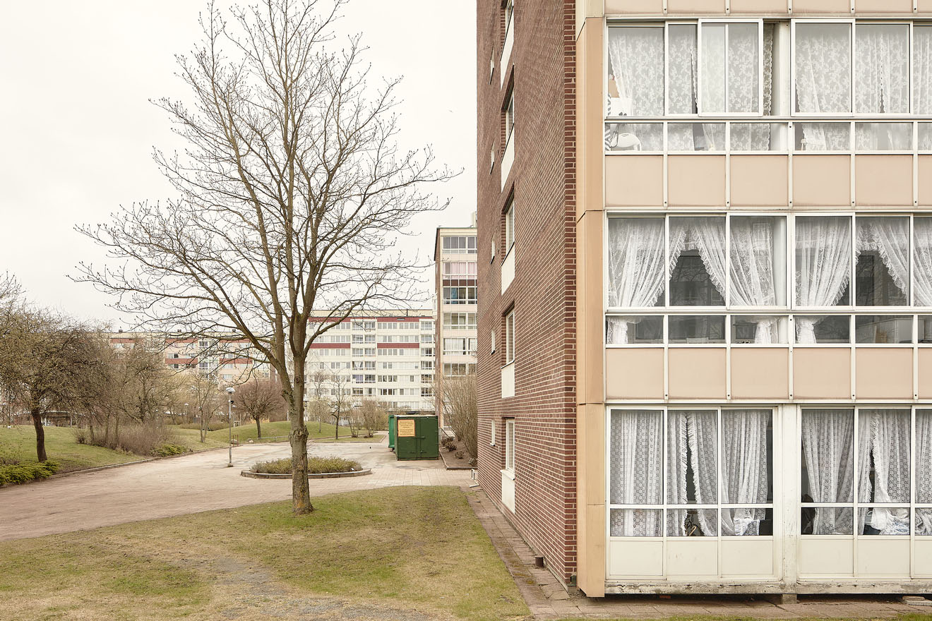
Photo: Alessandro Guida.

The track of a railway line emerges, and nearby mounds of earth herald something new on the way.
A lonesome mosque stands alone from the bare earth. In the distance, the noises of the rides that animate the night of Jägersro; the footprints of a horse launched at a gallop and the sign of water, an oasis of peace and nature protection reminds us of the origin of this place.
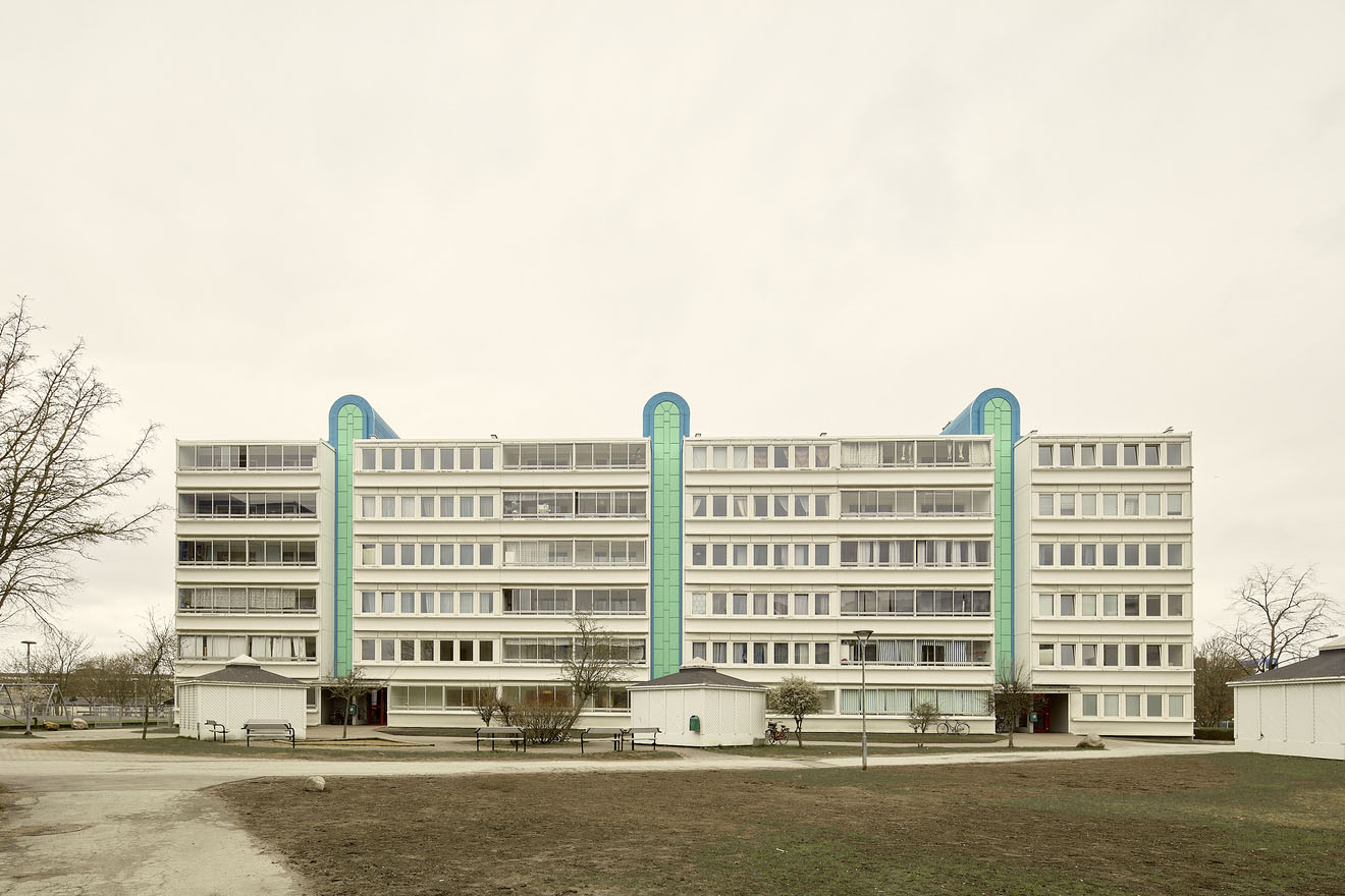
Looking north just beyond the inner ring, we enter a new dimension. Rosengård is one of the many neighborhoods of the Million Program created by the Swedish government between 1965 and 1974 to guarantee everyone access to a good quality home at a reasonable price. Many of these large housing estates are locates on the two sides of the inner ring; they have marked the housing policy programs from the 60-70s onwards. Become part of the urban grid today, at a first sight they appear frozen in time, crystallized; aged prematurely in the physical structures, yet accommodate new and diverse in the population which changes over time. Details emerge and tell a more complex story, a life that unfolds behind the windows, in the public space where new businesses have settled over time. Green spaces are overwhelming and stretch as far as the eye can see.
So tall and imposing, the large blocks dominate the landscape beyond the barrier of the inner ring. Beyond the residential area, one enters an unusual and surprising context, where many of the city’s industrial structures have been converted into small commercial businesses and cultural spaces incorporated into the urban fabric.

Photo: Alessandro Guida.

While modifying its assets, urban values and vocations, the urban pattern of the city has evolved. The development programs for the next twenty years are impressive and foresee an acceleration in the transformation of some of these inner portions of the city which represent the legacy of the industrial period. They have often become the ideal location for the creative and cultural industry, for young startups, spaces for the immigrant communities and the new generations of entrepreneurs, yet the renewal process put in motion is hastening the gentrification process. But the city’s growth has also speeded up the creation of new residential settlements and new commercial centers and spaces for businesses between the two rings, intensifying the occupation of agricultural land.
Following the path of our journey along the ring roads, it is again uncertainty of a landscape in transition towards new uses. Lonely agricultural areas abandoned greenhouses and warehouses for new distribution companies. More building sites in an area that is subject to an industrial development plan. We cross the edge of the city’s border and end in Burlov: trellis of a large electric power plant and a golf course and then back to Sege Park. Again, another large construction site where historical buildings are refurbished, and new developments embedded to experiment a new way to conceive a mixed urban district where shared services and facilities are combined with new housing provisions addressing different needs.
Treading the meadows on the edge with Burlöv, suddenly a trace of the railway track emerges from the ground and the industrial memory of the city materializes. We decide to follow it and arrive in Kirseberg.

Photo: Alessandro Guida.

We approach the neighbourhood from the abandoned track which is quite popular among the locals for relaxing walks. Across a gate in the fence, we enter Lockstallarna: this is where a century ago the production of trains’ engines and wagons began. Impressive and overwhelming red-brick industrial structures have been preserved. The same materials and forms molded the village around it. Unlike the rest of the city, here to mark the urban landscape is the small scale of the buildings, shops on the ground-floor, places where the community meet. A peculiar atmosphere, a mix which makes this place different and unique compared to what we have seen along the way. Tiny brick and colorful street houses make the district a world on its own: it is the “we, of the Kirseberg hills”, the story of a neighborhood born in the early twentieth century.
A consolidated space, with a history, and a dense architectural identity. Yet, this is also a place which seems on hold. Suspended, uncertain state between past and future. In the next few years, a massive new development is expected to bring into the district houses, working places and urban facilities questioning the relationship with the existing urban tissue and the integrated vision of the city as an organic system.
But today the district is isolated like an island emerging from the urban space around it. In recent times cultural activities and the creative industries have reconquered this area reinventing it. Informality brought new meanings, while nature took over on this uncertain condition: just over the railway edge, birch trees bend their arms on still waters between the warehouses.
Looking forward to meeting the sea once again we land on the coast. We move between Spillepengen and Frihamnen. There is no other way than approach the water from the large industrial port. This is where in next fifteen years huge redevelopment plans will be carried out. We have moved in semi-circle around the edges of the municipal borders, and we end our journey in the heart of the industrial city.
Text: Viviana Rubbo

Photo: Alessandro Guida.


